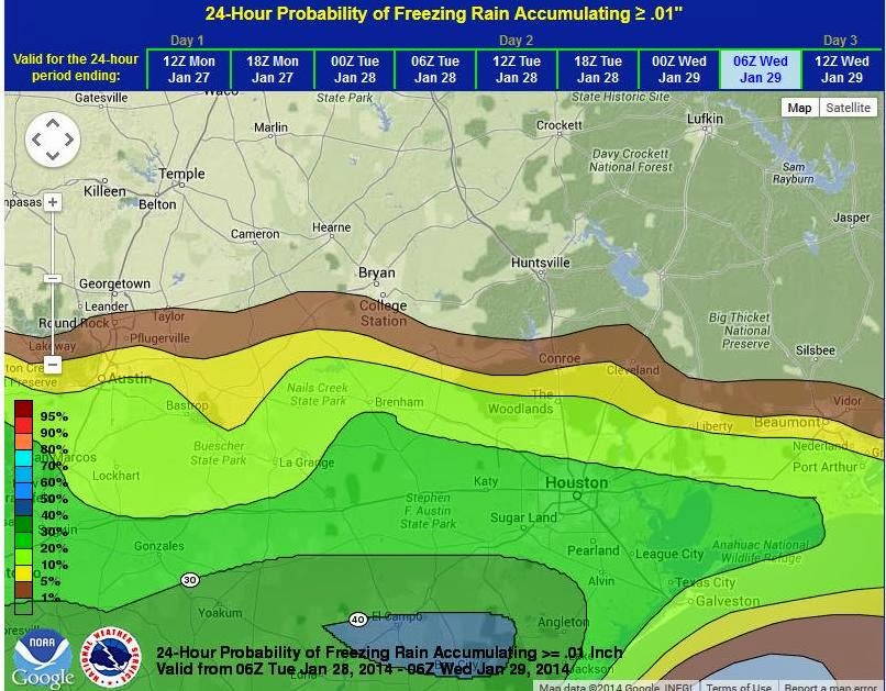
Wintery weather may return on Tuesday as an upper level disturbance moves in from the southwest. The exact track is uncertain and but an arctic cold front will have moved through on Monday bringing in much colder air. The incoming air mass is colder than the last air mass both at the surface and aloft which may support a range of precipitation types across the area. As the upper level disturbance approaches the threat for wintery mix of precipitation will be possible. It is still early and confidence in the placement and intensity will not increase for the next 12-24 hours.
Temperatures will be around 30-33 Tuesday morning and look to fall into the mid 20’s during the day on Tuesday with freezing conditions at all locations by late morning. If wintery precipitation does occur, freezing rain and sleet at 26-28F is completely different than at 30-31F. Colder temperatures support much more efficient ice formation and almost all liquid freezes producing much more significant glaze and icing conditions.
Stay tuned to local news and WxWarn for the latest updates.