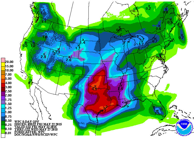
As we start the Memorial Day weekend, it is forecast to be a wet one for the Southeast Texas Region.
A frontal boundary moved into our region yesterday and has stalled over the region. This brings us the risk for isolated thunderstorms with heavy downpours through tonight.
The larger, more widespread event is expected Sunday through Monday as the boundary currently in place moves out and makes room deep tropical moisture to enter the area with an upper level storm system significantly increasing our risk for sustained excessive rainfall of 1-2 inches being commonplace across the region with isolated amounts from 4-8 inches.
This on top of already saturated grounds can lead to significant run-off and rapid flash flooding, specifically in the hardest hit areas.
Stay tuned to WxWarn and your local news for updates as we progress into the weekend.
 |
| NOAA Weather Prediction Center |


