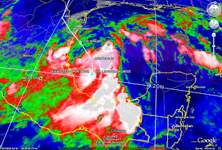
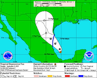
Tropical Depression 10 formed this evening in the Southern Gulf of Mexico. The storm is currently predicted to make landfall onto Northern Mexico sometime late Monday night or early Tuesday morning. The storm is currently moving to the North at 7mph with maximum sustained winds at 30mph and has the potential to become a Tropical Storm prior to making landfall. The current models are predicting the storm to take a turn to the Northwest over the next 24 hours. If this turn occurs later than planned or not at all, the Southern Texas Coast could see additional impacts.
No major impacts to the Houston/Galveston region are anticipated at this time.
The former Tropical Storm Gaston has diminished back to a Tropical Wave in the Atlantic over the past few days. It still continues its West-Northwest track but is no longer classified as a Tropcial Storm. Currently, it has a 60% chance of development over the next 48 hours.


