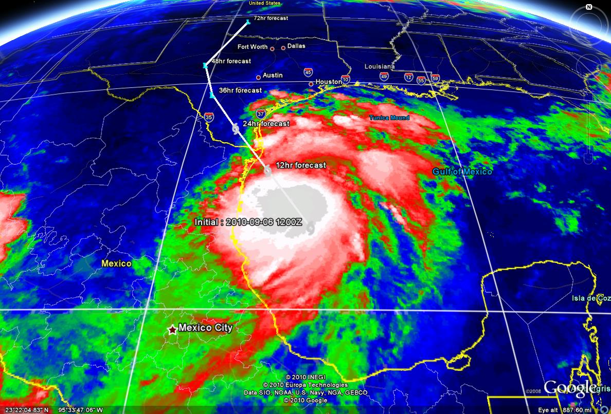
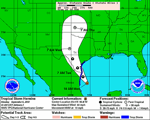
Tropical Depression #10 has increased in strength and progressed into our 8th named storm of the season, Tropical Storm Hermine. Overnight, the storm did not take as sharp of a turn to the Northwest as expected moving the projected landfall area into Northern Mexico and Southern Texas. Currently Hermine is moving NNW at 13 mph with maximum sustained winds at 50mph. The conditions are excellent for intensification, the latest guidance now brings Hermine toward hurricane intensity as it approaches the lower TX coast. Hermine is predicted to make landfall in the next 24-36 hours.
Warnings/Watches Currently Issued:
- A Hurricane Watch is currently issued for the South TX coast from Baffin Bay, TX to S of the US/MX border
- A Tropical Storm Warning is extended northward to Port O Connor TX due to the large wind field on the northern side of the storm and potential for a continue shorter term more northward track
The storm still is not projected to present a direct threat the Houston/Galveston region, however the watch area is only 100 miles to our South. Some secondary impacts we may see associated with the storm may include:
- Increased risk of heavy rainfall and/or flash flooding due to deep tropical moisture as the storm moves inland
- Increased tides and higher seas in the coastal area
Pay close attention to all storms that form or enter into the Gulf of Mexico.