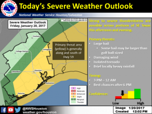
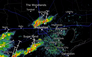
The risk of severe weather again this afternoon for Southeast Texas between 3pm to midnight tonight. Storms are already starting to fire to the East and Southeast of the Houston Metro Area. Heavy rains, strong winds and hail are possible. Rainfall is expected to be from 1-2 inches with 3 inches in isolated areas. The grounds are already saturated which increases the flooding threat.
Stay tuned to local media for weather alerts and check radar before heading outdoors or getting on the road as the storm system is expected to impact rush hour this evening.
 |
| Source: National Weather Service Houston/Galveston |
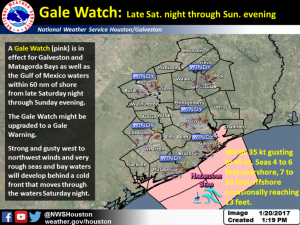
This event will be followed by unusually high winds upwards of 20-30mph (with higher gusts) across the region starting Saturday night late and continuing through Sunday. Secure loose outdoor equipment and decor as they can become airborne and increase risk of property damage.
 |
| Source: National Weather Service Houston/Galveston |


