A shift in frontal boundries and motion over the next few days bring us the risk of heavy rain throught the weekend. Currently, widespread 2-4 inches of rainfall is predicted through Sunday evening with isolated amounts of up to 6 inches in certain areas.
The area along and South of the US 59 corridor appear to be the area at risk for the heaviest rainfall; however, the entire region has about an equal chance of heavy rain at some point through Sunday.
These types of situations are very difficult to predict however all predictive models point to numerous thunderstorms developing along and north of the boundary Saturday afternoon and continuing into Sunday. The specific areas of interest may shift as the event begins to evolve. The risk of flash flooding may become present for areas seeing the heaviest rainfall, especially those low lying areas as the ground is currently semi-saturated with our recent rainfall. I recommend everyone to stay alert.
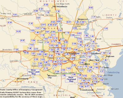
The current rainfall rates from last nights event are shown in the graphic below… (Source: HCOHSEM Website)


