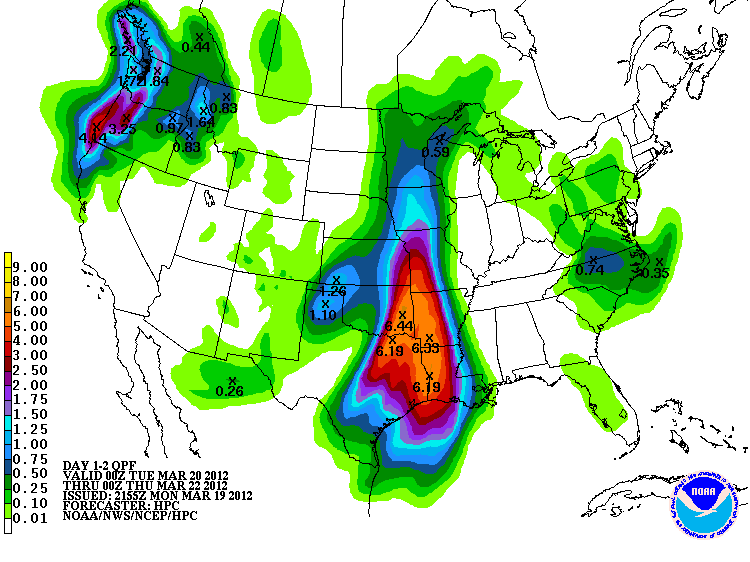
A strong storm system will be moving through the Southeast Texas region over the next 36 hours. The storm system is expected to bring from 2-4 inches of rain across the area with isolated amounts of 3-5 inches in some areas. As the system moves through, a strong squall line is expected to accompany the system bringing the threat of high winds, downbursts, and a slight risk of isolated tornadoes in addition to the rainfall.
The system is currently expected to impact the NW portions of the region between 3-6am in the morning (i.e. Brazos, Burleson, and Masidon county areas). The system will then move east reaching the far eastern portion of the region (Galveston and Chambers counties) by mid-day. The timing of the event is still uncertain as the model data is not in agreeance as to if the storm will speed up or slow down as it approaches the area and tropical moisture from the coast.
NWS HPC Quantitative Predicted Rainfall Over Next 48 Hours