A combination of a surface low and upper level disturbance moving in from the Gulf will bring heavy rainfall risk tonight to the south and eastern portions of our region. The highest rainfall chances are between 10pm through 6am tomorrow morning. Rainfall amounts from 0.5 to 2 inches locally are possible.
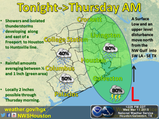
Due to the already saturated ground from our previous rainfall events earlier in the week and bayous still at a higher than normal level, this event brings an increased risk for localized flooding in the heaviest rainfall areas.
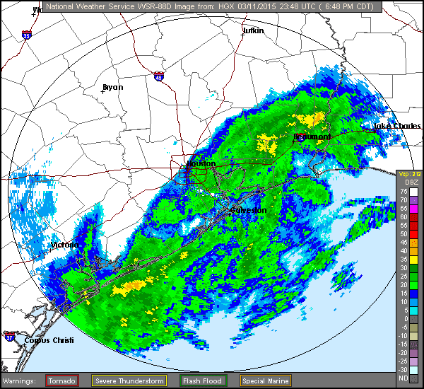
Rainfall in the southern portions of our region has already commenced. Keep a close eye on the weather this evening and check for flooding in the morning before hitting the road.
You can follow the current weather radar on the National Weather Service website at http://www.srh.noaa.gov/hgx/ and can check real-time rainfall rates and bayou flood status on the Harris County Flood Warning System at http://www.harriscountyfws.org/.