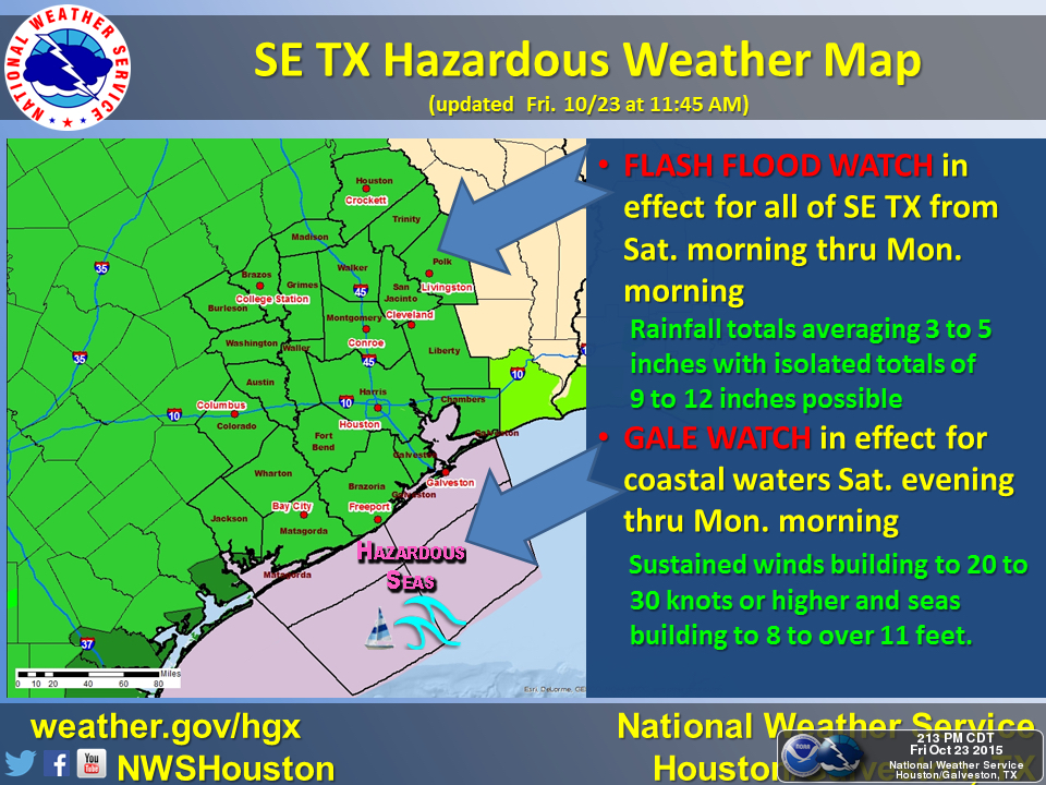
A significant flood risk is present for the Southeast Texas Region this weekend as a strong storm event is forecast to move through the area. The event currently appears to start impacting the Houston area on Saturday afternoon. Areas to the West will be impacted earlier. The storm will gradually move eastward into the Gulf late Sunday or early Monday.

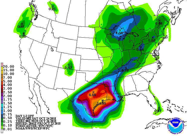
Average rainfall amounts of 3-5 inches are expected across the region with isolated amounts of up to 9-12 inches possible. Sustained winds blowing in from the coast are expected to reach upwards of 30-35 mph inland (comparable to light tropical storm force) which will also increase tide levels at the coast up to 3-5 feet.
Rainfall of these amounts, especially over short periods of time can quickly overwhelm drainage systems and cause rapid street flooding. A Flash Flood Watch is currently in effect and will likely be upgraded to a Warning as the system approaches. Remember, Turn Around, Don’t Drown!
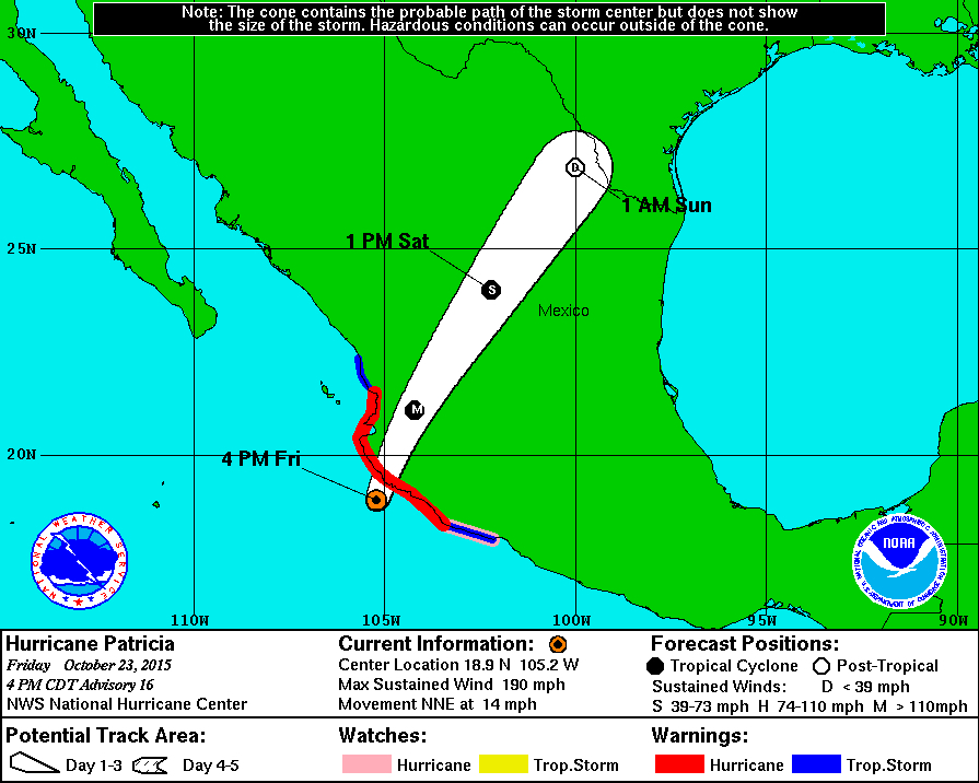
On another note, Hurricane Patricia, is now the strongest Hurricane on record in the Western Hemisphere on record as of this morning. As of 1pm CST, Patricia is a Category 5 storm with 200mph sustained winds with gusts upwards of 240mph and a minimum central pressure of 879mb. Just to provide a comparison, this wind speed is equivalent to a EF5 tornado, the strongest type of tornado. This storm is expected to make landfall over the next few hours on the Western Mexico coast near Cabo Corrientes. The storm is expected to weaken and break up as is passes over central Mexico, however it is being closely monitored due to the potential of re-development if it makes its way into the Gulf of Mexico. Keep monitoring this storm closely over the next 3-5 days.
Stay safe and stay tuned to the weather this weekend for updates, especially if out and about.


