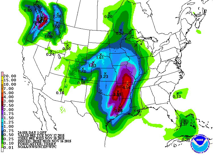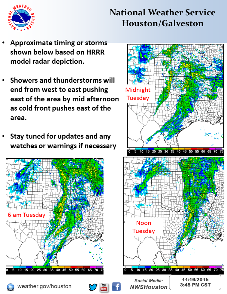
Risk of severe weather and heavy rainfall Tuesday morning into early afternoon for Southeast Texas according to the National Weather Service.
The main threat with this event will be isolated tornadoes and damaging winds which will be ahead of the main frontal line. Rainfall amounts of 1-4 inches should be expected with the possibility of higher isolated amounts. Timeline is currently looking to the height of this threat to be from 3am to 3pm Tuesday.
Stay tuned to local weather for alerts as the weather approaches. Stay Safe!
NWS Estimated Radar Timeline

NOAA WPC Quantitative Precipitation Forecasts