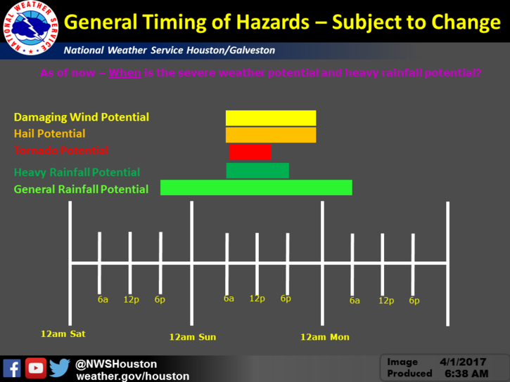
As we approach the end of the weekend, expect for some wet weather and some severe weather again on Sunday. Rain is expected to start this evening and severe weather is currently expected early Sunday morning. Although the exact timing is unknown (see timeline from the National Weather Service below).

Primary Threats are expected to be:
- Tornadoes
- Large Hail
- Damaging Winds
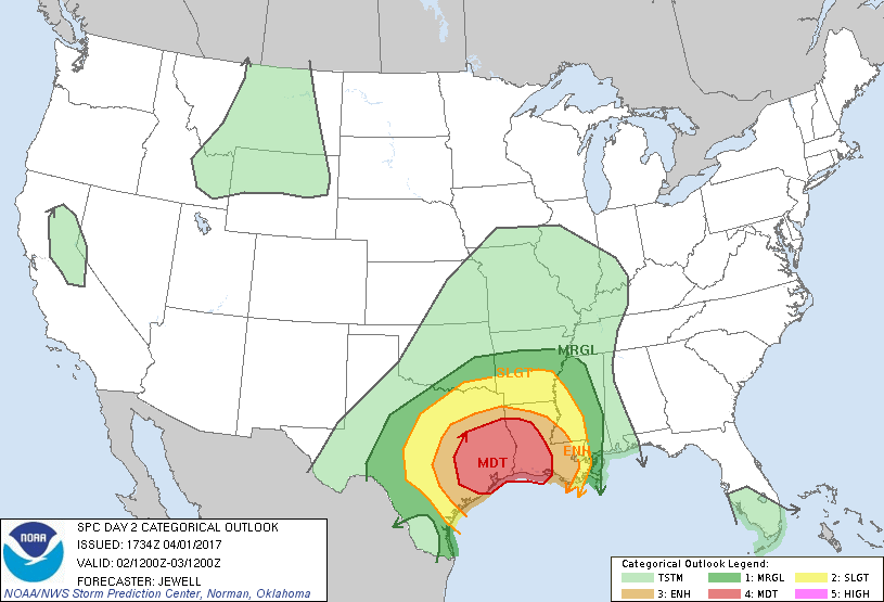
The NOAA Storm Prediction Center shows our Severe Weather Risk to be “Moderate” tomorrow (area in red below). Although “Moderate” may not sound like much, understand this is a 4 out of 5 on there severe weather potential scale, and the highest risk we have had in our area for a long time.
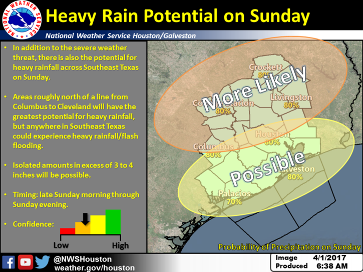
Flooding Potential
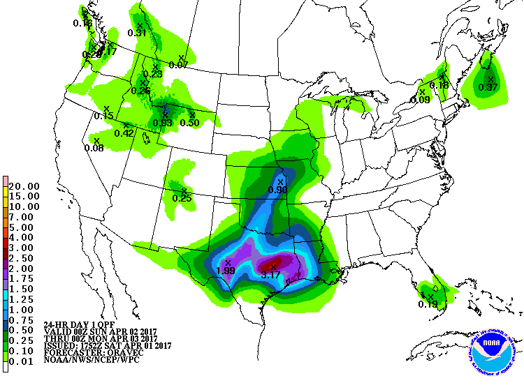
Following the severe weather threat, there is also the risk of flooding due to extended periods of heavy rains. Isolated amounts of 3-4 inches is possible. This is more likely in areas North and West of the Highway 59 Corridor.
Prepare Tonight and Stay Informed
Keep in mind that the severe weather timeline starts early morning Sunday while many are still asleep.
Ensure your weather alerting device is fully charged and operational before you go to sleep tonight (Phone, Weather Radio, etc). Tornadoes in our area can touchdown with little or no warning and it is especially dangerous at night due to limited visibility. Straight line winds with sever weather can also do similar damage with even less warning.
I recommend you practice your severe weather and tornado drills with your family tonight before bedtime as a refresher if you haven’t down so recently. Goto an interior “safe room” on the first floor of your home. The further away from exterior walls the better. Stay low to the ground and cover yourself with blankets if a tornado is imminent. Shielding yourself inside a bath tub is a great option if one is available in your safe room.
Stay tuned to media and close to your alerting device Saturday night through Sunday.


